Then and Now: Thor/Ray arterial
In 1926, Spokane Police Chief Wesley Turner had a map with all 621 car crashes in the previous 83 days. “Just a glance at the map is sufficient evidence to support the installation of the arterial highway system on certain of our Spokane streets,” he told the newspaper in 1926. The most dangerous streets at that time included Washington, Division and Monroe streets and Third and Sprague avenues.
Worse traffic arrived in the 1950s. The daily slowdowns were identified and a new arterial plan was developed. The citizens of Spokane approved a $2.9 million bond to implement it. Each arterial, oftentimes against the wishes of local residents, would be expanded to four lanes and entry to each arterial would be controlled by stop signs or traffic lights.
By the end of the 1960s, there many new arterials, including Belt, Alberta and Crestline streets and Mission and Bridgeport avenues.
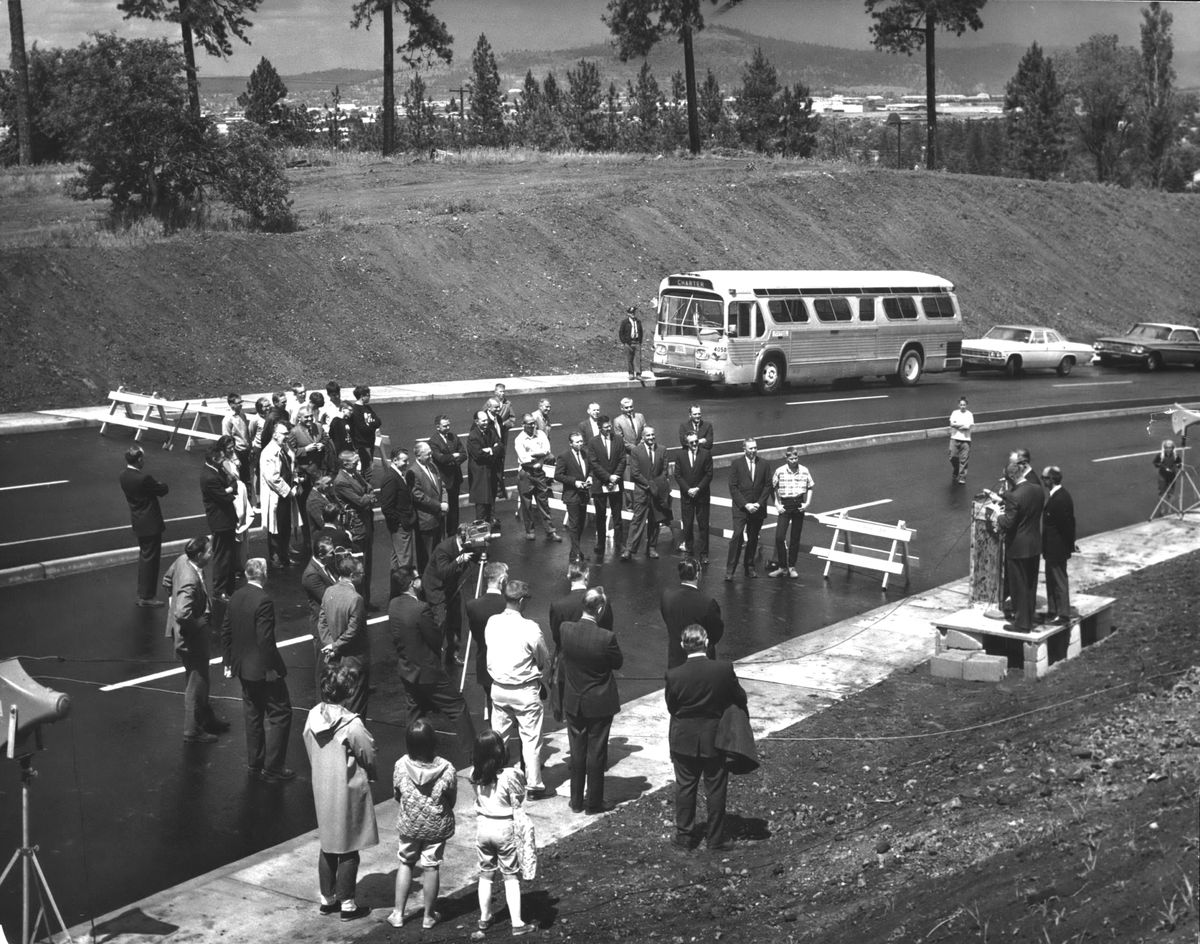
Market Street in Hillyard was a logical start for a north-south route on the city’s east side which could be tied into Freya Street for the south extension. But City Engineer A.M. Eschbach called Freya on the South Hill “one of the most excessive grades in the city.” The solution was to use Thor Street and tie it into Ray Street between 11th and 14th avenues, which was completed in 1966.
The Thor-Ray connection wasn’t controversial, but the natural south extension would push it through the middle of the new Ferris High School. One proposal to bend Ray Street to minimize the impact on the high school would still take 4.3 acres of the 50-acre school property. In the 1980s, the city continued to allow new housing in the area between 29th Avenue and Ferris High School.
Nearby Regal Street, which connects 29th Avenue to the old Palouse Highway, was a two-lane country road through small farms and acreages when it was designated as an arterial in 1963. Some of the money intended for the Ray Street extension was used to widen Regal to four lanes.
In 2017, the Spokane City Council officially removed the Ray Street-Palouse Highway connection, on the books since 1966, from the city’s comprehensive plan.